You are hereForums / By Discipline / Mountain (off road) / By Location / Australia / NSW / Blue Mountains / Blue Mountains Trail Advocacy / Great Blue Mountains Trail: Upper Mountains Component
Great Blue Mountains Trail: Upper Mountains Component

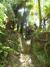
An interesting read for those that don't know about it: the feasibility study for the Great Blue Mountains Trail: Upper Mountains Component, dated Feb 2010. This is a shared use walking/cycling trail between Leura and Mt York.
Unfortunately it's not a mountain bike single-track or nature walk, but more like a tourist walk/commuter track. Still, would be a great thing to have anyway.
http://www.bmcc.nsw.gov.au/yourcouncil/policiesp...
It under "G", for "Great Blue Mountains Trail (GBMT) Feasibility Assessment". Look on the right for the link to the PDF, or click here:
http://www.bmcc.nsw.gov.au/download.cfm?f=3BD5B1...
Interesting things to note for the Katoomba to Blackheath sections:
- new 2-3m wide shared use trails only
- Only concrete, hot mix bitumen or cement-stabilised granitic gravel surfaces are considered
- the reluctance to use non-council land (e.g. existing access roads through rail and water catchment lands between Katoomba and Blackheath).
Only found a couple of updates on the web:
http://www.bluemountainsgazette.com.au/news/loca...
http://www.back-in-business-physiotherapy.com/he...
I think I'll ask council if they have any status updates, but feel free to post here if you have any info.
- Login to post comments
- Bookmark & share
Cheers for this Information
The concept of a Trail following the Rail was brought to the attention of Blue Mountains City Council in 1998 through the presentation of a petition, which included over 1000 signatures. The objective was to open one of several tracks, which follow the railway line, to public use as an off-road biking and hiking trail between Wentworth Falls and Mt Victoria. Several issues arose with this proposal. These issues included Sydney Water Catchment area, several non-integrated and stratified government departments, questions of ownership of the land adjacent to the railway line, safety - including the surface of the track, fencing, and gradients, environmental impact, as well as the the cost of building as well as maintaining another BMCC asset such as this track.
At the time, public access to the track between Medlow Bath and Blackheath already existed. However, the track between Katoomba and Medlow Bath went through Sydney water catchment land, but was still used illegally by commuting mountain bikers. This illegal use was necessary, as the Great Western Highway had extremely large amounts of heavy traffic on a very narrow road. The track to the west of Blackheath essentially followed an existing suburban street until it became railway land. Although car access had been developed and granted to rock climbers, early in the 1990's, by the late 1990's, there was a reluctance to grant similar access to cyclist and worse still a fence was erected half way along this strip to prevent any through traffic, hereby only allowing access from the west for climbers and their cars. A similar situation existed between Leura and Katoomba, where illegal bike commuting access was occurring along the southern side of the railway line. In this instance, this was occurring because the road trip between the 2 towns involve very steep hills, whereas along the railway line the gradient was extremely modest.
A public information campaign was launched through the Blue Mountains Gazette, as well as approaches to BUG's (bicycle user groups) in the Blue Mountains and Bathurst, schools, TAFE, outdoor communities, NPWS, as well as various Chamber of Commerce (esp Wentworth Falls and Lew Hird in particular), Blue Mountains Tourism as well as Blackheath and Mt Victoria community action groups. The former headed by Liz Bastian. Interestingly, both labor, liberal and some independent councillors and politicians mooted for the project. Surprisingly, the people who were least helpful were Bicycle NSW and the Greens!!!!
Correspondence was entered into with NSW state and Federal governments across many departments, including local sitting members, departments of transport, environment, health and tourism. Several meetings were held with many members of staff and people from the local community at BMCC, which were co-ordinated by Glen Sherlock. I personally invested a lot of my time investigating every plausible reason for constructing such a trail, by looking at comparative projects interstate and overseas, as well as investigating the nature of 'trusts' to take 'ownership' and maintain an on-going commitment to the maintenance and development of the asset.
Through continuous lobbying, the NSW labor government conceded the need for safe cycling across the Blue Mountains by agreeing to build wide cycling tracks along the highway during it's upgrading. The completion, in 2012, of the cycling track between Wentworth Falls and Bodington Hill is an example of this, and represents a vital link to the well frequented Andersons and Oaks fire trails between the upper, mid and lower Blue Mountains towns of Wentworth Falls, Woodford and Glenbrook respectively.
The effect : 1998-2013
BMCC received funding from the State Government , Dept Planning as part of the Greenspace Program to undertake the feasibility study which was completed in 2010. They again applied for funding from the same program in 2011 to undertake a Review of Environmental Factors (REF) for the trail which was completed in March 2012 and a Signage and facilities Plan was due for completion in June 2012. Both the REF and Signage Plan were requirements from the Dept Planning.
It was the intent of BMCC that during the next round of grants in September 2012 from the Greenspace Program that they apply for funds to begin construction.
BMCC also made application to the various State/Federal stimulus fund rounds without success until 2013.
After 15 years of campaigning, in 2013, Federal Labor Government make a funding announcement to develop the trail as far as Lithgow.
The Federal Labor Government today announced it would contribute $500,000 towards the construction of a new walking and cycling track in the Blue Mountains.
This funding is for the second section of the Great Blue Mountains Trail which will add 13.2 kilometres of new walking and cycling track linking the towns of Katoomba, Medlow Bath & Blackheath.
Minister for Regional Development and Local Government, Anthony Albanese said the trail would add to region’s appeal as a walking and cycling destination.
“Tourism is the primary economic driver in the Blue Mountains region and the trail will provide a new and interesting visitor experience and bring a positive economic impact,” he said.
“The new trail will generate tourism spending by New South Wales, interstate and overseas visitors and support local businesses associated directly with trail activities such as tours, cycle sales and hire, as well as for cafes and hotels.”
Senator for New South Wales Doug Cameron said the newly funded section will be moderately graded and offer the local community and visitors a safe connection through scenic areas.
“The trail will eventually go for 36 kilometres from Leura to Mt York, and to the lower mountains and Lithgow. Its moderate gradient will make it accessible and available to walkers and cyclists of all ages, including families,” he said.
“This project is a good example of the real benefits of targeted, long term investment in regional communities.
“The construction of this project, and the resulting increase in tourist numbers, are expected to create an additional 250 jobs in the region.”
Funding is being provided to the Blue Mountains City Council under Round Four of the Australian Government’s Regional Development Australia Fund.
Stage 2 of project will be completed in the second half of next year with the total 36 kilometre regional trail to be completed by June 2019.
Tuesday, 11 June 2013
Media contacts:
Minister Albanese: Virginia Kim 0407 415 484
Senator Cameron: Mark Andrews 0417 024 890
see : https://www.facebook.com/UpperBlueMountainsTrail...
www.back-in-business-physiotherapy.com/health-ad...
Thanks for this update, Martin.
Out of curiosity, are you involved in any way, or did you just happen upon the back-in-business-physiotherapy article?
Although I am unsurprised that neither The Greens nor BNSW were helpful, I am buoyed by progress on this and will watch developments very carefully.
In particular I am most interested how the track through scheduled catchment is resolved.
It will be interesting where they put it. Last I heard was that it would be on the south side of the highway which means no catchment or rail issues at least between Katoomba and Medlow. However that side in places is quite straightforward but in others you are going over some quite steep terrain as only the rail corridor and the actual roadway have a consistent gradient.... I think especially in the area after the explorers tree heading west... using the natural terrain won;'t be terribly family friendly.
It will be most interesting to see how it is done!
Martin is the principal of Back in Business Physiotherapy. I'm a a past client. He rides on the dark side mostly but has been known to use knobbly tyres occasionally. His practice was recommended to me by Steve Hogg.