You are hereForums / By Discipline / Mountain (off road) / By Location / Australia / NSW / Newcastle & Hunter / killingworth downhill
killingworth downhill

NB: Originally posted elsewhere on the Global Riders Network and appears via syndication.
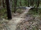
is any of these the downhill trail or remotely near it?

- Login to post comments
- Bookmark & share
Tags
the red track is pretty close - rode out that way last week and walked up a DH track to the top where two or three went off in different directions. The red track in your pic could be the one I walked up as I did come up from the two dams.
would it be easier to park on sugarloaf range road and ride down? because if you look closely on google earth the black track goes all the way up. or is it just easier to walk up the red track?
AFAIK the black track runs right up the guts of the DH trails.
Coming down off Sugarloaf Range Rd is really the long and difficult way to do it. It's a round about way to get there to begin with. I've also been told that black trail doesn't really continue right to the range rd and it is a very rocky and steep hike/climb at the top.
Same goes for an apparent link between the Killi trails and Sugarloaf Rd, very steep and rocky. Plenty of evidence it is a 4x4 rock climbing proving ground and way beyond anything I'll ever be able to ride.
The only rideable links I've discovered between Killi and the range is either right down the south using Archery Rd/Wakefield Forest Rd or in the north there is an old, falling to bits bitumen rd that heads down about a third the way up Sugarloaf Rd. And both of these are miles away from where you want to be.
Just go in from Killi like I said in the other thread. It is like a 2min ride or you should be able to drive in if your vehicle is anything remotely capable.
The yellow line looks to be roughly where the old Heaton State DH trail was. Stay off this one, it is closed and we (HMBA) had to close it down due to environmental reasons about 10 years ago. It was state forests but is now NPWS land.
The red line looks to start in the right spot but given the direction it takes, looks to be the blown out fire trail that goes west of Suckers Run on the XC network.
The black line looks to be the main fire road up the hill that you access the DH trails from. Browny, the rock shelves at the top are rideable, but only if you bring your skills on the day. Great run, but it is technical and the shuttle back to the top is massive.
so if i follow the black trail up i should find the downhill track alright?
and why did they close down the heaton downhill track?
Expect a to do a little exploring to find exactly where everything goes but I don't see how you can go too far wrong.
are the trails legal? or do people just no care if we ride on them? and i read on another thread there was 4 dh tracks, is that true?
how long are the dh trails?
These are not official trails and Killi as a whole is an informal riding area that is also full of motos and 4x4s. You ride there at your own risk but from what I've seen no-one is attempting to control access.
I have no idea how many DH tracks there are. All I know is roughly where they are. They are old trails that no-one is legitimately doing any work on. They could all be stuffed, there could be a million B-lines, extra bits or moto ruts.
To be honest I think the only way you are going to find out more is to get out there and start exploring.
Half the fun of mtb is getting out there and seeing what you can find.