You are hereForums / By Discipline / Mountain (off road) / By Location / Australia / NSW / Northern Beaches / Red Hill
Red Hill

Hello everyone I was just wondering if anyone could help me out here. I'm new to mountain biking and went to red hill for the first time today. I ended up getting lost and having a trek to get back to my car.
I went down what I assume is the main trail and past the houses on the left but then the track turned into a fork. I went right and ended up going down an awesome spot. I can only assume it was what's called rutsville as it was single track that had ruts everywhere and you had to be careful not to fall in. I kept going down and ended up and what I think was a retirement village in Cromer Heights where the trail seemed to just stop.
Now I want to know if anyone can point me to a place where I can learn the trails by watching a video or something so this doesn't happen again. Although a very fun trail not a fun ride home. Or if anyone wouldn't mind me tagging along one time so I can learn the trails while riding them.
Thanks,
Zack
- Login to post comments
- Bookmark & share
http://markie.com.au/mtb/track.asp?trackid=1&tra...
this guys website is GOLD
Thanks mate I have been looking at that but sometimes it is still a bit tricky when it comes to putting all the little pieces of trail together. I have looked since the ride and I saw some stuff that definitely helps. I wish I looked beforehand that's for sure.
See our Red Hill trails page.
Now...I know what you're thinking: it's old there isn't much detail. Yes, that's right, but this is a mountain biking community. We help each other out.
So if you think our Red Hill trails page is old, please, someone who knows - just hit the 'Edit' tab and type a few nice descriptions.
Easy!
Thanks
Firstly thanks heaps for the comments macca_chris. I'm a big fan and regular user of the trail maps on this site so it's important that I acknowledge the amazing work all the contributors have made over the last decade or so. What I try and do is add the anally retentive (first born lone wolf) angle.
Zack - My tip for a good starter loop at Red Hill is this one - http://app.strava.com/activities/33414509 but ignore that little exploration off to the left about halfway through.
If you want to swat it the trail names on my website are
Main Trail Section 1 - Upper
Main Trail Section 2 - Fire Trail
Main Trail Section 3 - Fire Trail Descent
Main Trail Section 4 - Rock Slide
Main Trail Section 5 - Figure 8
Main Trail Section 6 - Three Ways
Corner Cut - to the No Name intersection then take No Name (the rest of corner cut has some bits you will have to walk).
Sandbanks (until you hit the intersection of M7 - Left on M7 or short cut right to continue on Sandbanks)
M7
Western Edge (until the end)
then back home along the main trail.
However .. Sandbanks is actually way more fun on the way back than the way out .. especially the bit from the Main trail to M7.
I highly recommend heading out to the St Ives trails to build up your skills too. Less walking, less blood. And a really good indicator of improvement because when you start getting your "flow" (momentum, riding line, bike control) minutes drop off your time. Check out St Ives Horse Track and the Wild Flower Garden Single Track.
For a bit of variety, here is a ride I do regularly when I go to Red Hill. Might be a bit hard to follow as there are cross overs and tracks done in reverse.
https://www.strava.com/activities/102492344
I find a good place to start is on Cromer Rd. It avoids all the rubbish up the Beacon Hill end.
I'm happy to show you around sometime, Saturday afternoons or Sunday mornings I can commit to.
Thanks for the help everyone. I am trying to piece a whole ride together through your website mark it is extremely helpful so thank you for it. I am going to try the one you laid out for me today probably so thanks again.
Mike thanks for the strava I will try that and thank you for the offer to show me around. I will definitely take you up on that if you don't mind.
Geez the world would be a much better place if everyone was as nice and helpful as the mountain biking community. It's amazing.
Ok so I went out there again today after watching the videos and managed to get lost again. Anyway I forgot I had just got strava I'm not sure if this will work because I haven't really worked it out yet but if someone can look at my route and tell me where I went wrong that would be awesome.
Todays: http://www.strava.com/activities/103619715
Yesterdays: http://www.strava.com/activities/103368059
Hopefully this is how strava works I have no clue really haha.
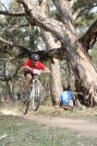
As you are riding out on the North Western side on the way back you climb a couple of loose rock sections (redish sharp rocks) before coming to a right hand turn. To the left is a rock .. go up that rock.
Picture
http://farm9.static.flickr.com/8289/7506786582_7...
Then follow the single tracks back toward the main trail. There are 3 options.
However better to head the other way.
On your map find the house at the top end of Northcote Ave. Zoom in/out so you can see the house and your trail route. To the left of the main trail are single tracks heading off to the left .. thats where you want to go.
Strava really helps - compare where you have been to the maps here on Nobmob.
The southern end of Corner Cut and onto No Name is a good one.
Don't worry, I certainly got lost up there many times initially and the one memory of a broken chain halfway in the middle of nowhere on my own with the light fading is certainly imprinted on my memory discs.Look out for certain markers as you're going...that helps a lot and I think you're doing great up there for a second ride
The rock you speak of in the picture now has 'curly track' in yellow spray paint all over it

I blame the Moto riders!
its really not all that hard?
it's a very small area bounded by roads, if you hit one then you just turn around and ride back the way you came or ride the road out ( if you get to the parkway near the bridge).
it's an adventure for sure, but not the labyrinth people are making it out to be here?
I will look at posting a red hill tour ride for next weekend.
I'd be keen to join in a ride as well up there. I've been there a few times, but only been mountain biking a couple of years and would'nt mind joining in a ride to get to know the trails.
Hey zack I'm in same boat! Been there got lost!! Anyone keen for a spin today
Easy for you to say!
The first time I went up there many years ago before the bush fires, I got hopelessly lost and couldn't find my way out. It was 32 degrees and I only had 1 bottle. Was in there for about 3hrs going round in circles and not far from calling emergency services!
Luckily now, I know every part like the back of my hand and it all seems so simple but I sypathise with first timers. It's not easy unless you have a guide.
Yeah it's a pain. I would be keen for a ride today if we can go somewhat soonish.
Also thanks again for the help everyone hopefully it will be better next time. As for the tour ride that would be amazing obmal. It also isn't so much that I got lost and started to worry more so that I would like to know a few specific routes that I could use so I know rough time constraints. So I would know if I could fit in rides before work etc. Going there and needing an hour and a half to find my way out wouldn't work if I only had an hour before I had to get home.
Good to meet up with you today Zack and explore. Been a few years since I have been up there and I thought I knew it better. I think we did well and covered a fair bit. There is a lot more trails and side tracks than I remember and we didn't cover too much.
Yeah it was nice to meet someone and ride with them rather than myself. Looking at the strava I have we definitely covered a fair bit. There is more there though like you said. I may have to try all those side trails one day soon.
I've made myself a PDF map of the Red Hill/Oxford Falls area when I was learning my way around the place. I initially used the KML files from this website & added bits & pieces as I rode them with my GPS. Its not a totally complete picture as I haven't ridden everything there & I only usually ride the northern end from the Sports Academy entrance, but its useful to print out & carry with you.
I can't work out how to attach the PDF to this post, but if you send me a PM with your email I can send it to you.
The whole point of the maps, etc. here is that anyone can edit and add to them. That's the best way to share info.
I admit it's not particularly easy to use, but has anyone tried using OSM? Drop me a line if you can't get your info up.