You are hereBlogs / Tristania's blog / The Snowy Mountains - A Mountain Bike Mecca?
The Snowy Mountains - A Mountain Bike Mecca?

After being told that we (my mum and I) were going to Jindabyne after one night in Canberra, I wasn’t sure whether it was worth the hassle of taking the bike. Sure, I loved riding Stromlo and Kowen Forest, but I didn’t think it’d be worth extra effort and expense in fuel to cart it down all that way, considering that the lack of information I had received about bike tracks around the Snowy Mountains was due to a lack of trails. I mean, I knew there was a great DH track at Thredbo, but figured that there wasn’t much more beyond that.
Turned out I was wrong. Several weeks before departing, I stumbled upon an article in an issue of Flow magazine that a friend passed on to me, describing what’s becoming of not one, but two great bike parks – Lake Jindabyne and Bungarra Alpine Centre. In an instant, I had reversed my plans and the bike rack was put on the back of the car as we drove down to Canberra for the night. The first evening was Stromlo – great riding as always; it’s hard to get segments such as Pork Barrel, Skyline and the Luge out of my head, followed by East Kowen Forest the next morning and (after a delay quickly getting a broken spoke repaired at The Cyclery in Canberra (which I whole heartedly recommend – you guys were great!) we were in Jindabyne that evening. And throughout my stay there (which was complemented with several hikes), I found not just the two said tracks to be great rides, but there are in fact five great tracks in the Snowy Mountains, which I will go about in detail here showing how you could make a brilliant 4/5 day holiday. Although time did not permit me to ride all of them, I was able to ride three, walk on one and collect info about another one so I can detail them here.
LAKE JINDABYNE
The Mill Creek and Tyrolean trail network begins about 500m out of the town centre and an easy (green circle) 7km links to East Jindabyne. Although marked as a shared-use facility, it is obviously built for bikes – with high berms, switchbacks and long sweeping descents - and is a brilliant track. Starting at the corner of Townsend St and Cobbon Crescent, the track traverses its way towards the dam (3.1km), over it on a separate path to the road and continues north for another several km to the East Jindabyne trackhead. And there are views of alpine forest and the lake all the way along, making it one of the more picturesque rides you will find.
Following back the way you came, it’s basically all downhill for four kilometres and you can get some pretty good speed on it. But don’t get too complacent – it’s the way you came up and there could well be others in the other direction. I had a very abrupt reminder of this when I saw someone in the other direction, resulting in my screaming on the brakes and narrowly avoiding a washout!
On the Mill Creek (East Jindy) side of the track, there are numerous intermediate and advanced tracks off to the side which you can try out if you want, however they are in varying degrees of condition. Some are fine; others are pretty overgrown. My highlight side trails included “Bunty’s South” and a very demanding and technical ascent, “Huff & Puff.” Altogether there are probably about 18km in this network, however, many of them are very demanding (even I couldn’t ride all the sections first go), and most riders will want to stick with the 14km out and back green track. Why not do it twice? With its proximity to the town centre, I did it each day I was there, and certainly did not get bored with it!
Word has it that a mountain bike track will link to this to go around the entire perimeter of the mighty Lake Jindabyne – that would be over 60km! If the tracks are made to the same quality, to quote the words of Steve Hawking, it “would be an ultimate triumph of mankind” – or at least of the Jindabyne Cycling Club. But even if there’s only 7km completed of that project, I would certainly recommend it for its “quality over quantity” – I’ll just be recommending it even more when the full loop is completed!
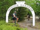
BUNGARRA ALPINE CENTRE + WICKED WOMBAT
I spent year 10 school camp at the Bungarra Lodge where we spent the day “mountain” biking – about 2km of singletrack and the rest dirt road. However the guys there aspired to expand their activities by building 20km of new track. It’s like a mini-Stromlo! A jump track, a pump track, a flow track and a skills course, of course along with newly built IMBA-rated tracks that traverse up the originally-titled “Round Hill,” and below the main Lodge itself.
The tracks remind me of Stromlo as well. They are well built, have many tight switchbacks and can be as easy or hard as you want them. There’s something for everyone; the segments below the lodge are mainly easy – but you can simply make them harder by trying to do it at a faster pace – and probably where they take the schoolkids, where the traverse of the mountain (the Garden Track) is very tough, full of tight switchbacks, drops, rocks and roots both going up and down (I actually found it harder going down as I had to be in control every second).
“Emu’s Run” is fast and fun, and one of the highlight segments of the park, along with the “Good Times” track. The Skills Park is pretty good with a green, blue and black line involving varying levels of jumps, see-saws, tight corners and bridges. The “Tokyo Express” is the long, easy way up the mountain, taking one to the “Copperhead Flow Trail” and the black-rated “Wild Goat Trail.” The wide assortment of tracks makes it possible for one to make a day of it, however you should be able to ride over all of the tracks within about two hours if you plan your route right. Since this is private land, they ask for a $7 fee for a weekend (or three day in summer holidays) pass, which is payable at the trackhead through an honesty box. The track is closed during other weekdays as it is used for school groups who are staying at the lodge, so make sure you’re there at the right time!
On NYE, Bungarra hosted their second “Wicked Wombat” 8 hour endurance race, which I was fortunate enough to watch (and photograph) the start, finish, and presentations. Contrasting to other endurance events where competitors get a time period to do as many laps as possible, multiple team members are allowed on course at the same time such that a team of two can be out the entire time as solo entrants and their lap total will just be the sum of their individual laps. TBH, I don’t know why they do it that way and I talked to several who were rather critical of it, but I guess it adds variety.
Being the first race I had watched; not ridden, it was interesting watching the contrast between the front group and the rear. All contenders seemed to enjoy themselves nonetheless and I got a number of photos to prove it. Apparently, the electronic system crashed mid-race, so the results were recorded manually, the most notable being Ed McDonald winning the Solo Male and Wendy Stevenson winning the Solo Female, the former clocking up around 170km in that period! Also noted at the presentations with a special prize was a rider who had crashed badly in the first lap, been taken to hospital to get her arm and face “repaired,” then went back to the event centre to complete another few laps! Bravo!
THREDBO XC
Although I didn’t get to ride in Thredbo on this trip, I was amazed to see how much MTBing has taking off there. Sure, I know that the downhill track is world class, and I had done 4km laps there at the Interschools championships several years back, but was unaware of anything else there. How wrong I was. On looking at the new map, there are no fewer than thirteen segments of track now in the village, including the new Kosciuszko Flow Trail, going down from the top of the chairlift to the bottom. From all accounts, it’s great fun for all levels. There are also several rides along the river, a skills track and a pump track.
For those wanting to ride the flow trail, it’s $30 for a mandatory induction to the chairlift and the tracks and another $70 for a day pass, so it’s definitely not the cheapest of tracks, but I reckon a worthwhile investment who want to experience something completely different. And you would be able to get about 30 rides of the track in that time. But for those who are (understandably) not so keen on the financial aspect of it, there are several tracks around that would be worth planning a check out of.
LAKE CRACKENBACK
Building MTB tracks on lodge and resort grounds seems to have become a thing. The Lake Crackenback resort, located on Alpine Way, just before the tollgates has sported all types of activities, and now has 14km of mountain bike tracks as well as a skills area and a pump track!
Making its way around the perimeter of the grounds, it sweeps around the lake and the houses and finally makes its way out to the river, almost an out and back, with the out and return leg only metres apart but you’d hardly notice it. There are picturesque views of the river and it is lots of fun with drops, rocky sections and tight corners making it a fantastic track. The skills area has see-saws, drops and bridges to balance on, making it an epic place to test your abilities. I had a lot of fun on the track with its large variety of terrain, and think that most people with some MTB experience would. Although this is on private land, entry is free, but riders must register at reception before riding.
CASCADES MANAGEMENT TRAIL
Despite being all fireroad, this looks like an EPIC ride over AMAZING scenery! Starting at the Cascades at Dead Horse Gap, a few kilometres west of Thredbo on Alpine way, I went on this track as a 19km out-and-back walk, and spent a good majority of the time thinking and talking about how much I’d like to (a) do a trail marathon covering the 50km length of it and (b) cycle on it. As I said, it is all firetrail, but as much of it has been grassed out to form two wheel ruts, making it feel like open singletrack. It goes through a variety of terrain, ranging from heavily wooded forests, long flowing rivers, vast open expanses and amazing views of surrounding mountain ranges, feeling almost surreal. Other highlights include the fantastic descents (reminds me a bit of Anderson’s) and well-formed surfaces that must have been shaped by many years of weather. There are two main ways one could do it:
1) Start at Dead Horse Gap and ride up to Bob’s Ridge (5km), and then down a long, fast descent to open alpine area. Cross a second creek, and ride for about 1km before coming to a track (which is unhelpfully not signposted) to the left, leading to the Cascades Hut (9km). This vintage structure still proves to be of use, having a fireplace, leftover tins of food and maps of the area, which come of use to hikers, and a great place to have a breather and a bite to eat. According to the topo map, it continues in a general downhill direction for the next ten kilometres or so, however most will want to turn around here so as not to make the return journey a massive uphill slog. This 18km route took about five hours when I walked it, so would be more like two on bikes depending on experience.
2) If you can convince your “significant other” (and no, I’m not referring to your MTB!) to drop and collect you at the other end, this would be an epic day out. Starting at Dead Horse Gap (or if you’d prefer not to spend $16 on the park entry fee, before the tollgate 15km back), and follow the track for about 23km, past the Cascade Hut and straight at the Tin Mine Trail, coming to the “Tin Mine” Carter’s Hut, according to the map, in a general downward direction. Here, turn left at the following junction, heading in a general SE direction over mostly undulating terrain before heading left at the junction with “Nine Mile Pinch.” Be warned, three maps of this describe this as steep and rocky stuff, descending 1000m in 5km (just to get some perspective, the infamous climb out of Anderson’s goes up 200m over 2km, so it’s double the gradient!), where you will hopefully be met by your dear “other half” at Pinch camping area for a long drive back to wherever you’re staying. Why not camp the night there? Overall it starts at 1600m and finishes at 300m – more than double the elevation change of Anderson’s and Oaks combined. I think this is about 55km all up, so riding back via the Barry way would be a long exhausting day with a bugger of a climb out! Needless to say, bring plenty of spares out there, it’s not the sort of track you would want to be stranded on!
On our walk, we passed a couple who with their bikes loaded with trailers that had been out for four days, so you can definitely go even further than that, even down to the Murray River and across the border. Maybe someday…
I cannot wait to head back to the Snowy Mountains for a seriously good few days, hopefully when the Lake Jindabyne circuit is done and I arrange to ride Thredbo and Cascades, but highly recommend it even as it is; the 150-member cycling club (of only 2,000 people!) has done a great job getting what they have done and hopefully they continue to do so. If you head to the Snowy Mountains with a bike in summer, you will not get bored!
For more info on these tracks, and several others in the area, check out www.rollingground.com.au.
- Tristania's blog
- Login to post comments
- Bookmark & share
... you've got me all inspired!
I should be down there now if not for work getting in the way of life. I love riding in the snowy, the trails are fun and there's no one on them.
I'm very keen to do the XC trail between Thredbo and Bullocks Flat (Valley Trail) it's 20km largely on a mild descent. I rode the first 6km last Autumn and it was great fun.
My other tip - make sure you drop into "The Sacred Ride" in Jindabyne, up behind the shopping centres near the Cop Shop. You can pick up trail maps for a small donation (that goes back into the MTB community).
Can't wait to get back there around Easter time.
... is that there is an almost complete shared use (walkers / bikes) track along the Thredbo River linking Thredbo with Lake Crackenback.
I just got back from there yesterday and wholeheartedly agree with everything you've said. Perhaps we passed each other 2 days ago just heading into Jindabyne from the dam? The young fella who was with me had a bit of a fall after stopping to let you pass just after you'd come across the bridge?
I did manage to spend NYE doing the Flow Trail at Thredbo and it's great fun. Like you say, you need to do an induction course so that can take up around 90min and the earliest one is 9.30am so you really can't get started until around 11am and the lift stops for bikes at 4pm so 30 runs might be stretching it if you have to do the induction. Once you've done that though, the following days would be much longer. Oh, and your arms, hands and quads take a hammering if you're more use to XC riding like me. Some of those braking bumps are painful after about 10 runs.
You can do the Flow on your own bike and you don't need a full face although they do recommend it. Nothing too techy, made hard by trying to go faster each run.
Visited Bungarra for a couple of hours (nowhere near long enough) and you're right, coming down the hill does require your full attention and is (in my books at least) a well labelled black run.
Can't wait to go back.
The Thredbo flow trail is free if you 'ride' to the top. I cant remember the xc trail that takes you to the top, but it is a cheaper option if you are fit enough.
Doing it this way you get more time on the bike and can bypass the induction process if you feel you are experienced enough.
It is hard work, and doing it this way i only managed 3 runs for the day.
D
When I asked at the counter if you could ride up they said that you can only get there by the chairlift and a way up isn't shown on the map so not sure how you do it. But for those who are happy to ride, it would be a cheaper (and more healthy?) option to ride all the way up and would certainly make the ride down more earned!
Just looked up my trail map - its called Merritt's Traverse. The map indicates that is supposedly 'guided only' but when
I was down there, there were plenty of people riding and hiking on this trail independently.
It is basically management trail / fireroad, well signposted with the std colour code signs, so you cant really get lost, but is a good option to get to the top, albeit a little slower.