You are hereForums / By Discipline / Mountain (off road) / MTB Events / " Hidden Valley Classic "
" Hidden Valley Classic "

NB: Originally posted elsewhere on the Global Riders Network and appears via syndication.
For the ride of your life !!...Sunday 14th Sept at Coolah.
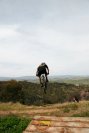
30-60-90k options...over 90% natural singletrack.
Entries are open, don't leave it until the last week...you'll miss out.
For information & photos, click onto link below, or google coolah bikeworx
- Login to post comments
- Bookmark & share
Tags
Love to enter but need more info such as profile, category etc. Is 1 loop for 30km, 2 for 60?
You'll find most details including gps track map, altitude profile etc on the link.
The bad news...yep, it's facebook.
The good news...you don't need to be 'on facebook' to access info.
As the info flyer states, it's one, two or three laps of a 30k loop (27.5k singletrack)
Categories...last year it was under/over 45yrs, seemed about right. This one's more about the ride than the results.
We have no sponsorship, nor do we seek any...we do not ask the local business's for hand outs. As a result there is no prizemoney, however, there are quality, locally handcrafted trophies & 'lucky draw prizes'.
Any surplus funds go to local community organisations/projects.
It's a small field ( 100-150 ? ) which is how we like it...it's on private property which we are fortunate enough to be able to borrow for the day, with degradation an issue.
N.B. Track map & altitude profile are from 2012 & no longer accurate as another 5k of singletrack has been added, however, they're not far out.
Is it just possible that someone may have a GPS track map & altitude profile from the Coolah 2013 "Hidden Valley Classic" ??
It won't be entirely accurate, as the track has changed again this year, however, it will be more accurate than what we have at the moment.
GPS... Altitude ( we are talking west of the great dividing range).. maps... 30+km of single track look in front and pump. Deal with what's around the next corner
Well, actually, no we're not. It doesn't always hug the coast as some believe. Coolah, on the western edge of the Great Divide, is 300ks inland with an altitude of 500mtrs...mountain ranges ( hills ) 5ks to the east, north & west of town are 800mtrs. The highest point on a road trip from Newcastle to Coolah is 6ks east of Coolah. 25ks NE of town is the intersection of the Great Dividing, Warrumbungle & Liverpool Ranges (up to 1240mtrs )...as high as anywhere in the Blue Mountains. We certainly don't claim it to be a mountainous region, however, it's not exactly a billiard table either.
While the "Hidden Valley" track offers only about 600mtrs of vertical climbing per 30k lap, it seems to keep most competitors busy. The GPS map is for our Safety Management/Evacuation Plan & the altitude profile is for those who have asked for one...I'm guessing it's the smart ones doing some homework.
Dunno if this will work, but this should be a gps trace of 2 very slow laps last year......
You need to go to Garmin Connect and make that public (padlock icon).
http://connect.garmin.com/modern/activity/376469243
Great job on the info Lach...thanks heaps for that.
This is a great event put on by locals with a good sense of humour. Camping at the venue (showground) is very good. There is nothing too technical about the course. A nice climbing workout but nothing too long or steep, just a whole bunch of small climbs all over the valley. Very nice groomed singletrack and lots of flowing runs. For me this 55k course takes 1.5hours longer than the Husky 50. Warning: watch out for what the locals call Cats Eyes - massive thorns in the grass - don't go off line or you will probably be flatted. The riders from the country areas all use goo in their tubes because of these. Have fun!
There are no catheads anywhere on the bike track. However, they are scattered in various locations across the Recreation Ground, including the parking & camping areas. DO NOT ride your bike anywhere apart from the track or short course area. With good rains after a drought, catheads grow like mad...fast, hard & sharp...the sneaky mongrels then lie around for months/years waiting patiently for someone to turn up, either with bare feet, or on a bike...or both. Invariably, someone does.
After some winter rain, the track at "Hidden Valley" is firm & fast with green grass for miles. We believe that you won't find a more enjoyable 25ks of unbroken singletrack anywhere...of course, we could be wrong ? Unfortunately however, it can be ridden on one day only, this year it's Sept 14th...entries close Sept 10th, don't miss out.
Numbers were well down, due primarily to a clash of dates with various other events. However, it was a great day nonetheless...the weather was perfect, the track's never been better & the riders, as we've come to expect, were just a great bunch with the right attitude. Thanks to all those who travelled to Coolah for the event, hope to see you in September next year.