You are hereForums / Preparation / Geek Gear (GPS/Comps/Lights/etc.) / GPS - Garmin 510, 810 or are there other options
GPS - Garmin 510, 810 or are there other options

I've been looking around on the web, but haven't really found any recent forums or reviews of GPS devices for mountain biking. So was hoping someone here could chip in with their experience.
Garmin seems to be the place to start. In their range it seems to be either the 510 or the 810 that are the most likely options.
Talking about Garmin, have anyone tried the vivoactive for mountain biking?
Which other options would you consider? If any?
[Mod. moved to geek gear]
- Login to post comments
- Bookmark & share
I have a Garmin Edge 510 - it works fine, sync's up to Garmin Connect App.
Was easy to set up with Heart Rate monitor and Cadence thingy.
Getting the right info on each screen takes a few goes but gives you some thing to do at night.
When you just have one info display per page the font is a tad too small - that's its only fault (or maybe I am just too old with poor eyesight).
The 810 adds a lot more features in terms of maps and linking things up - so if you are tech savy and cashed up - go for it!!
CC
Disclosure: I did not pay for my Magellan as a mate worked in marketing at the company and organised me a unit and some kit. He left to go back to South Africa in November last year.
http://www.magellangps.com.au/blog/wp-content/up...
For me there are three great functions I love, which I am not sure if other GPS have (but they may). Wireless upload to your computer....I just get home, press the "wireless sync" button, and by the time I am out the garage and in the front door, my ride is uploaded to Strava.
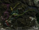
Secondly, the mapping. When we went on holiday to Rotorua, all the trails were already mapped in and we could just navigate which was awesome.
Lastly, the "surprise me" function. You can enter that you want to ride for "x" hours on hilly/flat terrain, including on-road or offroad etc and it will devise a route, whether it is back to the same point or to a new destination. This is great when you are on holiday and don't know the local rides.
Here are some reviews.
http://www.magellangps.com.au/blog/media-review-... ….pretty cool for an iPhone boy like you
http://bicyclingaustralia.com.au/2014/12/magella...
is another option. I was fortunate enough to win one at the Kal 50/50 last year (Based on luck, not performance )
)
Unfortunately, I have no experience whatsoever with Garmins so can't give you a comparative analysis.
The 505 is well spoken of in online reviews (Flow mag also reviewed it locally), apparently representing very good value-for-money. Also bear in mind that it has come a long way since the first software was released.
Apart from some issues with it refusing to talk to the computers I had available (XP & Vista. Was told it most probably had something to do with it) and a tendency for heavy rain drops to activate the touch screen (I read on some forum that putting a screen protector was helpful), it has performed well for me.
Consistency of data (GPS distances, waypoints & elevation) is pretty good when repeating the same courses.
The point made by Cpt Chunder about age/eyesight is worth taking into account. The 505 is larger than the Garmin but that comes with the bonus of a larger screen with larger information. I'm at the 2.0 reading glasses stage and I can read the info without them at a glance, which is very appreciable.
The riding info displayed is very flexible. You can select the number of fields and what data you want in each field (from a very extensive list)
It comes with roads and some trails pre-loaded and they've just added more trails, which I haven't had a chance to check out.
Uploading to the Magellan Cyclo site is straightforward though there was until recently some discrepancies in distance data (I think they might have resolved that).
I'm not into Strava but apparently, it is compatible.
It's got a lot more features which you can easily learn about online.
For myself, apart from the pc connection problem, I've been happy with it.
I just use the Garmin Fit app on my Samsung Galaxy 5, which has built-in ANT+, links with cadence and heart rate monitors no issues. No need to buy a GPS at all. Automatically updates to Garmin Connect, which is the website view and I use tapiriik.com to sync with Strava.
Garmin just released the Edge 20 & 25. Very small and cheaper than the ones you mention, but they don't have barometric altimeter. Depends if that's on your 'must have' list or not.
Lezyne released some pretty small and good looking devices recently too.
My wife bought me the 810 about 18 months ago a a 30th present. I had told her I would be happy with the 500 but the guys at the shop she went to talked her into the 810.
They told her about the live tracking and mapping capabilities........ Live tracking requires data from your phone - which doesn't happen here in the mountains. The Garmin mapping is also dodgy - it's fine for roads but does not know many firetrails. The route following also directs you the shortest distance between way-points not the route you've planned........
I've got a 510, been pretty happy with it. It's seen almost daily use for 18 months and still going strong. Doesn't have a mapping function as such but it's quite easy to import and follow gpx files.
A big plus for me is how quickly it picks up satellite reception. Connectivity is a bit iffy - I upload rides to Strava via phone bluetooth and it works but is a bit buggy.
I have an 810 and have been happy with it. It has had its moments but since being reset and the software updated it's been fine.
I bought the performance pack with no maps and used the Open Street Map instead. That has nearly every mtb track and trails.
Route planning and following is easy using Garmin connect or better still, one of the many free online tools.
The live tracking is normally pretty good as long as you have signal on your phone and if it does drop out, it catches back up once signal returns.
They're not cheap but I recommend them for mtb and or riding new places.
I have the Garmin 800 but never use the maps.
Use it on my road bikes, along with my iPhone.
For MTB it's too likely to get damaged. I've already had to pay to get it replaced once. Plus, when I'm hammering along the last thing I want to do is look down and take my eyes off the road.
Everything MTB gets logged on my phone which stays in a padded pouch in my camelbak.
The question is: Why do you need a bike gps?
-If it's just to log rides, use your phone and keep it tucked away.
-If you need to monitor your stats, a Garmin 500/510 will do. (Keep in mind, all the fancy features of the x10 series need to be tethered to your phone... so you'll be bringing your phone along, or missing out)
-If you need navigation you'll need an 800/810.
I've had mine for a few months now.
Very quick to fire up and pick up satellites.
Haven't used mapping but I would really only consider it for roads.
Upload via Garmin Connect to Training Peaks and Strava is now bulletproof with current updates.
Why would I not use a phone?
GPS on the phone eats battery big time. As I like to go for long rides of up to 4 hours and sometimes longer, not being able to call for help because a bloody ride tracking app has sucked my battery dry is too much of a risk.
Plus I have a HRM, speed and cadence sensor, and PM.
I have a Garmin 510 but started out using an iPhone with an application for GPS. The main initial feature I wanted was the ability to keep an eye on my Heart Rate. I have a Polar HR watch but needed to wear my prescription glasses to read it...yes getting older plays havoc
I decided that I didn't require maps but if you do then as others have indicated you will require something a bit more upmarket.
If you are just tracking your ride and don't want to monitor your HR etc while riding then a smart phone in a back pack (other than battery life) may be sufficient. I find the 510 does more than I probably require and am discovering new things all the time on Garmin Connect.
You can configure multiple displays to show a multitude of parameters. I find for MTB riding besides my number 1 of the HR I have the average riding speed, distance, total elapsed time and calculated calories.
When you get home and synchronise your ride to Garmin Connect you can trend your parameters and have a look at the GPS map of your ride etc.
The latest thing I discovered on Garmin Connect was "Segments" which is managed automatically by Garmin from your data. It is probably a bit like the strava you talk about in that it has a list of other peoples rides and where you are ranked. I even found one for Marrinup Full Loop which was interesting.
The reviews indicated that the display can be a bit harder to read than the previous Garmin 500 and I have found it to be a bit dark on a dull day but it has a backlight that is able to be configured to suit.
In general for what I need I am happy with the Garmin 510.
Whatever you decide to purchase I recommend that you look at the "Bundle Packages" as they are better value for money and cheaper in the long run.
Not sure if you're aware of this article:-
http://www.dcrainmaker.com/2015/07/introduce-seg...
Basically its a software update that allows your starred Strava segments to come up on screen so you can race against your PR or KOM in real time.
Sounds like a great addition to me. I'm looking forward to the update.
I've had mine for about a year and find it suits my needs perfectly.
You can set it up with a heap of info set how you want. For example for racing you may just use one screen showing whatever is important to you such as heart rate, distance, cadence... and the less you put on the screen the bigger it is so makes it good for quick glances in a race.
For morning cruises you can set multiple screens to flick through with lots of info to break the boredom - battery %, temp, alt, speed etc. and can load something like 8 different items on each screen.
Then there's the maps - if I'm going somewhere I haven't ridden like the first time I did Lysterfield in Melb by myself you just flick to the map and follow. If you get lost just set it to find home and it will direct you back to where you started your ride.
When I start my morning ride it picks up all the sensors and satellites in about 20sec. When I finish my ride I walk in the house, click the WiFi button and it just uploads the ride instantly via my home WiFi to the Magellan website which then forwards it to Strava. By the time I walk to the kitchen and look at the laptop the ride is ready to view on Strava.
Probably the only concern is battery life. After a 5hr ride I usually only have about 20% battery left and that's without using maps so I'm sure it would chew it up quickly if you ride around watching the map screen.
Fatboy, have you tried decreasing the screen brightness to save power, or setting the backlight timer on an appropriate value?
Yes @CyclinAl, I have the screen brightness set to half way and backlight goes off after 15secs...
I see you mention rain can interfere with your touch screen. I had similar problems with my sweat changing screen, pausing my ride etc so then worked out how to lock the touch screen so now a quick push of the home button then allows me to use the touch screen.
Edge 520 has been announced and looks pretty cool...