There are a few sites popping up that can do this. MapMy Ride and GPSies both have elevation introduction options.
Although I'm guessing they both use STRM data which is only sampled ever 90m (horizontal) in Australia. Good for big long hills, but if there's lots of up and down in a small space not very accurate at all.
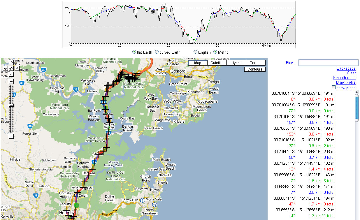
Do you ever find that when you ride in wet or cold weather you can get crazy elevation profiles on your Garmin edge? Guess its related to the Barometric (air pressure) altitude calibration. I rode today and it looked like I was riding off 300m cliffs when I got home and checked the profile!
Yes indeed, when a storm front comes through it does play havoc with the barometric thingo. With some smarter S/W that could be corrected (well - if you're doing an out and back, or a previously known route) but give more accuracy than the useless 'MB Gravity' feature on MB which is probably SRTM data also.
Check the two small holes in the back of your Edge...I remember reading on the MB forums that they lead to the barometric sensor...and people noticed that if you have water (drops) in there, (e.g. in rain) they could block the proper baro readings...
my 2 psi
Rgds, Hans
__________________
May all your lines be the right ones...


There are a few sites popping up that can do this. MapMy Ride and GPSies both have elevation introduction options.
Although I'm guessing they both use STRM data which is only sampled ever 90m (horizontal) in Australia. Good for big long hills, but if there's lots of up and down in a small space not very accurate at all.
Do you ever find that when you ride in wet or cold weather you can get crazy elevation profiles on your Garmin edge? Guess its related to the Barometric (air pressure) altitude calibration. I rode today and it looked like I was riding off 300m cliffs when I got home and checked the profile!
Yes indeed, when a storm front comes through it does play havoc with the barometric thingo. With some smarter S/W that could be corrected (well - if you're doing an out and back, or a previously known route) but give more accuracy than the useless 'MB Gravity' feature on MB which is probably SRTM data also.
Check the two small holes in the back of your Edge...I remember reading on the MB forums that they lead to the barometric sensor...and people noticed that if you have water (drops) in there, (e.g. in rain) they could block the proper baro readings...
my 2 psi
Rgds, Hans
__________________
May all your lines be the right ones...