You are here
XC


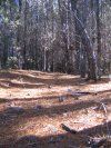
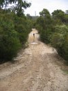
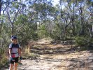
Mount Tianjara
At a Glance
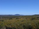
Miles and miles of firetrail with spectacular views all around. Is this a cross country rider's dream?
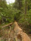
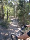
Ourimbah State Forest
At a Glance


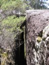
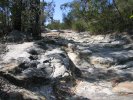
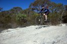
Huge Humps

Reverse angle - Riding some lush single track you'll come from this direction and head down a dip and up over the top of this hump. Three ways down this side which is pretty much vertical and around 3m high. Ye-haaaaa - love it!
Championship downhill course, many Km of single trail and even further firetrail - Ourimbah has it all.
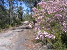
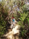
Wingello State Forest
At a Glance

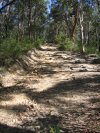
Wingello Pratiwi

Heading back to the car (which was parked crn of Forest/Caoura Roads - dumb idea, don't do that). As you can see, it's been a great day here.

Large (1,200+ ha) State forest with the usual firetrails spread across it, but with more hills than (sort of) neighbouring Penrose State Forest make it a bit more fun. Gets rated as just 2 blown lungs because you can take things real easy in here.
Manly Dam
At a Glance
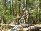
Downhill Fun
Take it easy - the decent to the creek is fast, rocky, slippery in the wet and full of gotchas.
Update: As of December 2006 this trail had some access work and has changed to more of a Downhill Freeway 
Heartbreak Hill
There's often not much grip here. Lucky this little climb is short and sweet - power on up there!
Sadly this was graded sometime around Dec 2006, so there's no real challenge in it left. After that it looked like this.
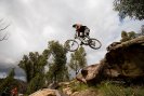
19th Hole
Biggest drop on the circuit and 6 foot plus. If you didn't turn right at the end of the boards then you're probably lying broken here.
One of Sydney's best rides - From Less experienced to Intermediate and even Advanced, all enjoy this ride.
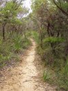
Oxford Falls (Morgan Road)
At a Glance
Sandy Fun
Between the two rather serious climbs here there's a section of trail that's quiet sandy.
Perfect for playing around as T-Bone demonstrates (well - if you check the original full size, you'll see he's on one wheel here).

Also know as Morgan Rd for it's meeting point this area has heaps of trails to join up and make the ride anything you like. Most of these have at least one or two technical sections, many are 80%+ technical!
Terrey Hills / Duffys Forest
At a Glance

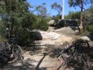
Anembo Junction
Curling round to the left is shorest route back to the fire station. To the right where the bikes are is that short cut across the circuit and out of shot (to the camera's left) is the supposed route to Bibbenluke.

Fire trail. Not technical, but one of the best views at the end of the Long Trail. Some more challenging climbs to be had on the options south of Booralie Road.