
You are here
cworbc.org.au

Surly Fat Bike
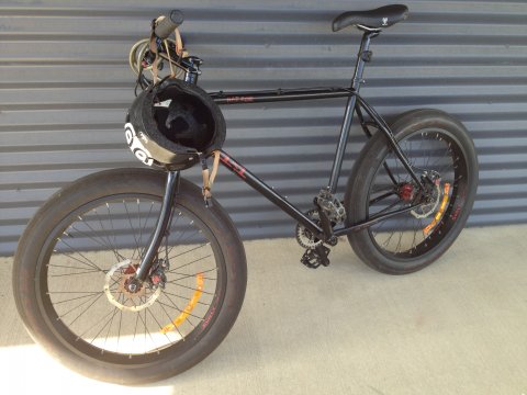
I think I want a Surly Pugsly or Moonlander, who has experience with these bikes and wants to share? I have a Rat Ride and love it, also a 1x1 frame gathering dust that has a pile of parts lying around it that need bolting on (standard 29 rims).

In Orange 17-19 of January
Hi All,
I'll be in Orange for a long weekend from the 17-19 of January. Sounds like there is some great XC riding around Orange and I should bring my bike along.
Anybody local up for some rides Friday, Saturday and/ or Sunday morning? I can try to find my way around with GPS, but I guess it would be much nicer (and saver) with somebody local to show me the trails.
Please let me know.
Cheers,
Volker

The biggest challenge of Joes Track.
Right near the end of Joe's Track (or Eat at Joe's) there's a tough climb that culminates in this rock.
"The Big Rock" - on the Goat Track

The normal direction is actually riding up this bit, but is fun to ride down too.
Mt Bulgas
Mt Bulgas Reserve is the highest point in Kinross State Forest (well technically it's in the adjacent reserve).
The view used to be better when the trees were shorter but it's still not bad. It's all downhill from here but a good challenge to climb to the top!
Kinross State Forest update for 06 Nov
Kinross is a little dry and dusty but riding quite well.
Do you have more information?
If you've ridden here lately please add a more recent report. This will be useful even if the condition is the same as updates expire after 30 days.
Please do not post comments with such information - post a new update with the link above.
Please do not update this post with such information - post a new update with the link above.
Bald Hill Information
There's a good map sign at the trail head and the tracks have coloured arrows to follow.
Geurie train station
Geurie train station is around 500m from the trail head. The station exit is on Narragal St. Cross the trail line, turn right on the Mitchell Highway then Chambers St is first left. Trail head is at the end.
Chambers Street parking
There's parking available on the dirt road, at the end of Chambers Street right by the trail head.
The Walls Lookout - Mt Canobolas
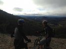
The view from the Walls Lookout at Mt Canobolas (with Joe and Grant) looking towards Orange. You can see The Pinnacle too. It was cold.