Submitted by Little-Ditty on Wed, 10/01/2007 - 10:46.
Rob,
Me and a mate have been riding through a section of Terrey Hills that does not appear to be highlighted in this map. I can't tell if it is being described in the words contained in the Terrey Hills "rides" or not.
It is at the "turn left or right" at the electric fence. If you turn right, it was described as being very steep and overgrown. Well, yes, it is. But if you back track 100m back down the firetrail hill, the gate is the entrance to a side track towards Waratah Park. This cuts out all the ultra-steep downhill, making a new section of single trail.
If you continue along to the right then, you will skirt the outside fence of Waratah Park, but this does not lead anywhere in particular. As in, it is not a loop. It is just a trail that wanders along, adding about another 400m one way to your ride. You would have to turn back at some point as this is heading slowly downhill, and will be ending up in the river at some point. I never did that bit
What use is this? Well, this is some continuing single trail to ride that may be new to some people. It is a slight uphill gradient on the way back, making a nice little push if you want it. Also, there are some cool little 2' or 3' rock ledges to jump off on the way. It can pass some time as the group stops to check out one's form. I thought it was fun. Has anyone else also been out in that bit?
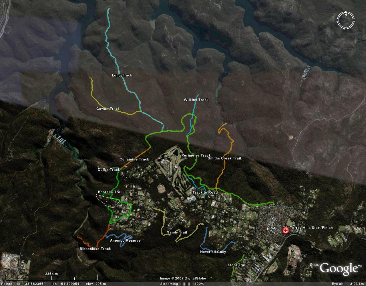
Cheers!