You are hereForums / By Discipline / Mountain (off road) / By Location / Australia / NSW / Blue Mountains / First time at the Oaks (Woodford to Glenbrook) - Am I going to get lost?
First time at the Oaks (Woodford to Glenbrook) - Am I going to get lost?

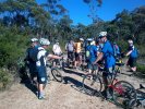
Hello all, I'm very pleased to report I'll be doing Woodford to Glenbrook for my first time ever tomorrow.
I'm chomping at the bit to get going and have even dug out my special riding pants.
I'm just a little nervous at getting lost on the trail. Is it fairly well signposted on the trail or am I likely to get lost?
I've had a look on this site and the FatHippy's but I think I probably need an idiots guide.
- Login to post comments
- Bookmark & share
Tags
http://nobmob.com/rides/theoaks
pretty hard to get lost on this one ,if you are not sure just follow someone there is allways plenty of riders doing" the oaks"
Thanks BT.
I've just got an image of being that 'guy' who goes out in the blue mountains with a Tim Tam and a can of coke and gets rescued 4 weeks later by the SES...
Once you're on the right trail at Woodford, is fairly obvious or does the path fork in a number of places?
Also, when you get to the St. Helena 'turn off' or the Nepean turn off, is it fairly well signposted? I know I must sound like a sissy girl (guilty as charged) but just not sure what to expect.
Ta.
Just don't miss the single track. The single track starts at the middle gate after the long down hill run from the helipad(clearing) and runs parallel with the firetrail to the Glenbrook creek causeway carpark. There will be plenty of other riders out there tomorrow if you get stuck. And make sure you stop at one of the cafes in Glenbrook!
The are a couple of out and back forks, just check the map at the middle gate. You won't get lost and if you do I'll find you later that day when I'm out cruising! Just save me a Tim Tam.
Have fun!
You pretty much have to be looking for the St H's turn off. for The Oaks you basically just stay on the main fire road till you get to the gate at the start of the single track.
Ok ride, nice views but over all over rated....
Hey! I'll be rationing the Tim Tams!
Thanks for the advice re the single track... Bet you any money I'll get lost!
Also, there was a Magpie at Woodford last year too. So watch out on the second corner after you leave the station.
Roger... I'll bring my tennis racket for self defence!
very straight forward, just dont turn off on the side trails unless you want to do some exploring or site seeing.
Okay, so,... I got lost. But, in my defence, i was stupid.
For some reason, I thought St. Helena finished at Glenbrook. Clearly, not the case.
I also picked up the trail to Springwood halfway down the St Helena Track... Also not the right way.
Had an amazing day and the St Helena track was amazing. A few trees across the trail, but nothing you couldn't get over.
I love the Oaks, I love the Oaks!!!!
The St Helena track will take you to Glenbrook if you go to the right at the fork. I wouldn't say it's the best ride(carry) out to Glenbrook though.
So I take it you rode back up to the Oaks firetrail.
I'll have to remember that one.
Sounds like you had a great time.
"So I take it you rode back up to the Oaks firetrail"
Yep, rode back... thought I'd found another trail which ends up going towards Springwood... amazing... but still the wrong way unfortunately.
It was a bloomin' amazing day and can't wait to get back there.
In the interest of public safety, I should mention that at the 'end' of the St Helena trail (i.e. where there is that little swampy pool when the trail gives out), my friend almost trod on a snake... Be careful out there.
That swampy pool is the Duck Hole and it is a relatively short climb out to Glenbrook. You made it into a real long day.
I thought the Duck Hole might have had a good clean out with all the water that has been over the causeway further down, but appears not. That used to be a swimming hole when I was a kid, but last time I was there you could walk across without getting your feet wet. Erosion from urban development will always be more of a problem than anything a few people on mtb's can do.
"The Duck Hole" eh. Thanks for that. Nice to put a name to a ... hole?? Anyway, yeah, it's good to get the lingo.
I appreciate this might sound like one of those "I've this friend right... and he's got a problem of a personal nature..." statements, but my riding companion nearly trod on a snake at the duck hole and the prospect of tramping through the bush hoping to pick up a trail lots it's appeal for her.
I was hoping I may have 'ran into someone on the way back out, but no dice. Although saw a couple of walkers (believe it or not).
It really must be dry then as it looked like this last year when I was there. http://nobmob.com/node/340
Did you go down chute to get to the creek?
Hey Chuck, damn that looks pretty water locked. It was at most 2metres wide when I was there.
As for the Chute... I think so. I only saw one route down. I took the official St Helena trail off the Oaks fire trail (going towards Glenbrook). Then the main trail takes a sharp left (where there is a sign for weed spraying in progress, that's been there since at least Jan this year). Incidentally if go straight on instead of left there you pick up this amazing thin trail lined with wild flowers that takes you all the way to Springwood (very reminiscent of hte scene from Gladiators... I digress).
I say I think it was the Chute as it was so steep, I don't think I've descended anything steeper... and bear in mind, I had to cycle back up it when I couldn't find the trail past the Duck Hole! Boy did I sleep well that night!
That trail doesn't go to Springwood, unless you've got abseiling gear. It takes you to a place called Lost World lookout iirc, where you can see Springwood, but the chasm that is Glenbrook Ck at that point is not easily crossed.
Last time I was down that way, there was a dead dog all bloated and floating upside down across the crossing point. Which was nice.
Also thinking of doing oaks for the first time. Is there any signage or anything that i can use to make sure i dont miss the single trail?
just follow the wheel tracks from where you chicane through the logs at the gate just before the Oaks picnic area. Follow the track across the Red Hands Cave fire trail and then its pretty much all marginally downhill sniggle to the car park at the top of the crossing. There are a couple of bail out points onto the tar in the last km where it gets a bit techy.
Like Lach said, when you reach the gate at the mid point. Ride between the logs on the left, through the gap in the gate and then follow your nose all the way to the finish.