You are hereForums / By Discipline / Mountain (off road) / By Location / Australia / NSW / Newcastle & Hunter / Killingworth All Mountain/Easy Downhill track
Killingworth All Mountain/Easy Downhill track

I have just been for a ride at my local trails here in Killingworth. Whilst most people know about the great singletrack out here, I am not sure if many people know about the old downhill track and the tracks that shoot off it. I have been interested in linking together some of these trails to make a good All Mountain/Easy Downhill track, and today I think I might have been able to link together trails to make this track happen. I rode the trail today in its unloved form and it was great fun. I am planning to start doing some work to make the trail nicer, and put up some signage. I will ride the trail with my Garmin GPS and post the link to show where the trail lies after I have done a little work. Watch this space if this sounds like the kind of trail that you would like to ride.
- Login to post comments
- Bookmark & share
Is this track the one that comes down from Sugarloaf, or one further south? Anyway, go right ahead, should be awesome.
Killi is further south than the sugarloaf trail
where does the killingworth trail start? is there a shuttle road and is it still rideable? would really appreciate if you could get back to me
No shuttle road. Park at killi and head up the hill on the northside of the powerlines. Keep following the single trail till you hit a fire road. Follow this up the hill (past the steep rutted section) and eventually there will be a cleared area on the right. This is where the trail starts. It immediately goes to the south of the fire road.
After the rain forest section the trail branches, right is the old state track, left is the long track.
If you follow the long track, you come back onto the fire road, through some trees and a jump on the left, then back into singletrail on the right. The trail branhes here was well. Right (and over the back of a berm) takes you onto the last club track, or following the berm takes you down the long track. The long track is pretty easy to follow from there and ends up in the car park area (the other trails don't).
I will see if I can find a map.
This is where I think the finish of the 'long track' is.
Assuming you can find Killi, turn right onto 'The Boulevard'. Someone has actually put up a 'MTB' sign on the power pole.
A few hundred m and you will come to a power line easement, take the dirt rd off to the left. I usually ride in from here but the road looks pretty vehicle friendly. You will go under the F3 and about 50m later veer to the right.
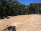
Just around the corner you will come out into another easement. I counted two sets of power poles (on your right) and the road goes through the third set. If you stop here and look to the right you will see some trails coming out of the bush.
I think this is the end of the DH that Sammy refers to (I could well be wrong!)
To the left and down the hill a bit there is a huge pile of rubbish which is where some of the XC trails come out.
could you make a map of that? i think i know where you mean, but i really dont want to mess it up and get lost.
Browny, you are correct, that is where the long track ends.
Anyone rode these trails lately? How are they looking? Thinking of giving them a go when it drys up
Don't ride it ion the wet, the sandy clay eats drivetrain. Not pretty, you can literally hear the dollars grinding away.
You weren't lying about the drivetrain. I thought I would be right, not too much rain lately but damn. Still very quick in some spots fortunately.
I entered near the "trash" on the left at the third power pole. I was on the track with the green arrows soon enough. There are some very tough technical ups in that track. I lost the track once or twice, it could help to have it properly marked rather than arrows on trees. Very impressed nonetheless, wish I had discovered it sooner. The little bridges over the gullies are wicked.
Will it be better signposted after the "killikaze" on the 30/11 you think?
Can't really be signposted much worse tbh. Like you I lost the trail a few times today, or was just uncertain whether to go straight or not.
For a while the green arrows and safety tape work well, then in the second half both are near non existent. Shame as I had an absolute blast today, those climbs hurt for a big guy, got them mostly anyway.
Back when HMBA was based at Killi, we had all kinds of trouble posting trails. Even on race days the tape would be pulled down by motos or 4wd.
There is so much trail there I would suggest you just explore until you get a feel for it. Heaps of good stuff out there.
Oh definitely can see how the locals are a big issue out there.
One or two laps of the killikaze track would be all you'd need to remember the track layout.
Judging from all the bearded dragons I saw, there'd be snakes galore waiting to get you. Got tangled up in some tape on the way back down the hill I'm the rear cassette and nearly had a heart attack.