Funny you mention this. Given all the recent talk and that dam I had a look, South is in their restricted zone (soon to change hopefully!) but north + west is in a 'special' area with no restrictions at present.
If you look South there's a large quarry of some kind. Will post the KMZ soon-ish I hope.

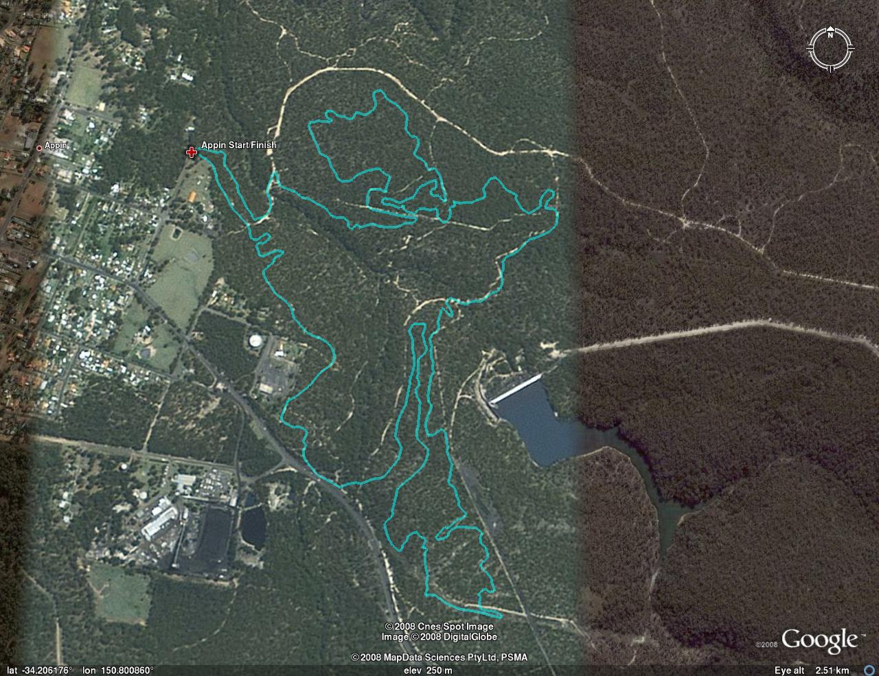


This looks pretty close to the Cataract Dam. Does this area not fall into the SCA's restricted zone Rob?
Funny you mention this. Given all the recent talk and that dam I had a look, South is in their restricted zone (soon to change hopefully!) but north + west is in a 'special' area with no restrictions at present.
If you look South there's a large quarry of some kind. Will post the KMZ soon-ish I hope.
Cataract Dam (and the surrounding Schedule 1 land) is the other side of Appin Road.
A large portion of the land belongs to the Dharawal people
like a long 9 km track or is it a longer part that I haven't ridden yet ?
Nah - that is the lap used for the WWS in '08 I think. It's somewhere between 9-10km.