You are here
Mixed
The Great North Walk
Mostly double/single track with some wider stuff in places.
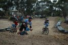
XC Circuit (WWS '08)
Really should split this up when time allows.
Hilversum Crescent Entry
This track is maintained and is security gated by Ausgrid. This track runs over Aboriginal Native Title and National Parks land. National Parks personnel have patrolled this track, and have fined and prosecuted people with NSW Police personnel in their National Parks vehicles. It is illegal to enter this track and fines apply. National Parks also have a camera mounted at the entry (it is camo' green) to collect information of trespassers. Have not been told if there are others.
Blue Gum Swap
Although the topo map says Blue Gum Swamp trail runs along the ridge line just to the East of this valley, signs at the location seem to suggest this trail down in the valley is Blue Gum Swap.
Mixture from firetrail in the North, to thinner, almost single track in the middle opening up a bit to almost firetrail again at the South end.
- « first
- ‹ previous
- 1
- 2
- 3
- 4