You are here
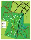
Trail map
Green Point - node and land use status...?
NB: Originally posted elsewhere on the Global Riders Network and appears via syndication.
Below is a preview, click to read the full post
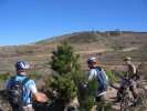
Went out to Green Point last weekend for the first time and found it was a lot of fun. However had no idea where I was going most of the time and wasn't able to find a decent map of the trails before or after.
Having had a look thru the older forums, there has been some discussion previously about checking with council about using Green Point. Was that ever done as I can't see any updates since that discussion? From what I can tell, Lake Macquarie City Council would appear to encourage its use for cycling but there is nothing specific I could find about use by mountain bikers.
Mugga Hill Trail Map (Dubbo)
NB: Originally posted elsewhere on the Global Riders Network and appears via syndication.
Map for Mugga Hill Trails near Dubbo.
Bald Hill Reserve Trail Map (Geurie)
NB: Originally posted elsewhere on the Global Riders Network and appears via syndication.
Here's a printable map of the Bald Hill reserve tracks at Geurie.


