You are hereForums / By Discipline / Mountain (off road) / By Location / Australia / NSW / Northern Beaches / Narrabeen Lake loop - help?
Narrabeen Lake loop - help?
So i'm looking at doing the nice flat Narra Lake loop this weekend with my g/f and possibly other friends.
Now I know the majority of the way around but i'm still a bit unclear on where you go after the Sports Centre....
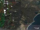
On exiting the Centre you have to ride along Wakehurst Pky for 'about 500m' in an easterly direction, then take a dirt road to the left somewhere to make your way to the foot bridge over the creek, correct? Is this left turn off Wakehurst Pky in between the two road bridges? Is the course i roughly plotted on the image below about right?
Any help would be greatly appreciated. I am after the flatest path possible.
Cheers guys,
- Login to post comments


Yes you have it mapped well
The trail Nth to the Iron bridge across Deep ck. is on the straight bit of road only a few hundred meters west from Deep creek it is easy to spot as there is a boom gate follow the trail in .
There are two paths to the bridge so you should at least find one , its a fun ride down the steps on the other side , we call it the cheese grater for obvious reasons if you crash.
When you leave Deep creek reserve don't cross the road there is a gantry under the road bridge that links you up with the Lakes trail
The only other issue is if you bump into one of the Militant groundsman/managers in the Fitness camp they dont like bike riders in the camp.
Have fun I am planning the exact same ride with my daughter this week
Last time I took the left hand turn and went over the walking bridge the trail was overgrown and difficult to find. The alternative is to stay on the Wakehurst Parkway until after the road bridge over the tributory (another 200 metres on from the turnoff) then turn left into the park entrance and then go under the bridge.
Okay thanks for the info guys. I will try and follow your directions Dez, but if it is overgrown i guess we can just stay on the road till after the bridge.
Cheers,
_____________________________
my Intense 5.5 ~ my NS Suburban
The section east of the footbridge has been cleared and significantly widened in the last fortnight or so. Enjoy the ride.
I dont suppose anyone has a GPS log or similar for this ride do they?
I may have a GPS log at home, I'll have a look tonight, but you should be able to work it out from this
http://www.warringah.nsw.gov.au/community/NLMult...
For the red-dashed-line-bit, you'll just have to make it up as you go along. The only bit that might not be obvious is where you get across South Creek from South Creek Rd to the Golf Course....
I did part of this today, the section from Wheeler heights to Narrabeen is a really nice ride.
As you make your way through the gold course could you keep an eye out for signs? Last time I was there we saw something about the public right of way changing soon, it would be good to know if this has been updated recently.
Cheers
I did the golf course part yesterday. The sign on the gate from the Institute of sport just says that the gate is unlocked whilst they are in negotiation with the council. I didn't see any other signs that referred to public access to the course. I didn't think I was in the right place, but when i saw some tire marks figured I was right to ride.