You are here
Black Diamond
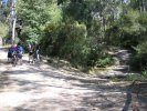
Old Bridle Track
A very challenging ride downhill that will most likely see you walking sections. Hike-a-bike going up.
Olivet Street Jumps
A series of very challenging Jumps for the Airborne inclined.
Mitchels Pass Hike-a-bike
This old walking trail can be used as a Hike-a-bike back to the top. It isn't easy.
East Gully drop to Cycleway
This drops off the eastern fire trail and is quite a steep decent with places of exposed rock face to descend. A creek crossing (usually dry) and a steep climb will bring you out on the cycleway between Jesmond Park and the John Hunter. Trail condition is fairly poor, lot of wash aways and more a technical decent.
Hunting downhill singletrack
Redundant Stairs
Advanced loop
Del Sin
The State Track
It's short, it's rocky, it's steep....
It's got a prick of a push up from the shuttle road to the trail head but worth every bit of effort
DH "Stringline"
The approved Downhill Track at Knapsack.
Starts at the highest point on the fireroad and descends across "Lovers Walk" (note be careful here and look out for walkers!!!), then becomes single track all the way down.