You are here
nobmob.com
What do the colours mean
Hey
Just found you guys on a google search, when researching Manly Dam. I'm pretty much a beginner rider, and today I attempted the Quarry track on the Cascades labyrinth. I went at it from down in the valley up (not the best way to take it), and found it incredibly difficult (I also got lost at the recycling depot-did you know you can see the city if you take th wrong turn-right intead of left-at the top of the trail), but I managed, and I still have all four limbs in working order. So i was wondering if there is a link to a key of what the colours mean on the google earth overlays, or would someone care to explain what they refer to.
The Oaks
At a Glance
The main Oaks Firetrail is one of the classic Blue Mountains rides, but there's more in this area than just that.
Steep descent
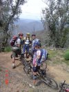
Steepest downhill ever. 50 metres before the bottom, my hydraulic cable gave way because the oil had over-heated. I also had rotor-shaped burns on my calves. How did my calves get to the rotor - you had to sit so far back your chest was on the seat, check the guy in the photo here.


