You are here
bmorc.com
Andersons update for 09 Mar
Do you have more information?
If you've ridden here lately please add a more recent report. This will be useful even if the condition is the same as updates expire after 30 days.
Please do not post comments with such information - post a new update with the link above.
Please do not update this post with such information - post a new update with the link above.
Andos, bedford ck
Wondering if anyone been down on the Andos since the rains and have an idea if bedford ck is ok.
I might head down there tomorrow and thought I better check...
ta
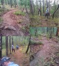
First preliminary rake... lots more work to do.
Fresh trail
More cut trail.
Finalising the last section
Nearly done!
Erskin ridge FT gpx
Hi All,
Been out riding Tableland road and saw this 30km offshoot near the end: Erskin ridge FT, goes all the way to Warragamba. Would love to see the elevation profile. I'm guessing - especially with all that corrugation on Tableland - it'd be a pretty huge day of approx 90km...
Anyway, just thinking..., if you have a gpx, pls share!
Thanks a bunch!
The Resurrection of Lumleys Climb
The meeting times are 'ready to ride'. If you need time to prepare equipment then please arrive a few minutes earlier.
There's a car park (click for foggy picture) on Springwood Road - just down the way from Hawkesbury Heights if you're looking for a suburb name.
Join the Facebook event
This is the trackwork session you don't want to miss, one word....Lumley’s!
We have the last round of our Summer 4hr Series on Sunday the 19th and we would like to use this trail. If you’re not familiar with it, it’s the trail to the right part way in the climb out of Max's Bridge.
This trail hasn't been used for some time because of major erosion but we have plans to resurrect it, this is the biggest job we have attempted in a long time.


