You are hereAndersons / Andersons
Andersons
At a Glance
Think of this as The Oaks big brother. Longer, steeper, rougher, tougher climb at the end, harder to get to. Up to the reader to decide if these things make for a better ride.
Meet at Woodford Train Station to catch the train up to Wentworth Falls.
Although the keen can combine this with The Oaks in which case you'll want to meet down at Glenbrook.
Another area we're naming after the most well fire trail through it, Andersons and The Oaks are all too easy to compare due to their similarities. As with The Oaks report we won't go into too much detail here as there are other sites that do that and have been around a while longer.
What does need to be said is that if you've done The Oaks a few times and are looking for more of a challenge then hit Andersons - you won't be disappointed. The style of ride is similar and you'll probably want to travel up via train and then ride back to the bottom (via an enormous climb - if that makes any sense) where you started.
So beginning from Wentworth Falls station, you'll want to head East on the Highway until seeing Tableland Road turning on the right. Of course roads are nasty, dangerous places to be avoided at all costs, but in this case we can make an exception due to the goodies they lead to. Head down here for a few Ks until the dirt starts outside the hospital.
Left at Andersons Firtrail
On some rather fast fire trail (this is actually Kings Tableland Road) you'll pass Ingar on the left (more about that later) before getting to the main turning left to Andersons. While enjoying the speed on this leg, remember that Kings Tableland Road is open to 4WDs and you are likely to meet one coming the other way!
Luckily a locked gate at this turnoff should mean you won't meet any more motorised traffic for the next 25Ks or so. This is lucky, as they'd probably get in the way and slow your progress down the madness that is to come 
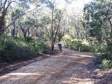
Smooth, smooth trails that are narrower than most firetrail you'll find in these parts, combined with a nice gentle gradient spur riders on through some great forest scenery. There's only one possible directional mistake to be made here, where a right turn needs to be made around 700m from the left turn onto Andersons proper.
Getting deeper into the trail things get steeper and a lot rougher. More and more care is needed to keep control down here. It's all great stuff, but all good things must come to an end - eventually a creek will be sighted, which depending on recent rainfall can be crossed or bypassed via rocks to the right.
Another brief blast along fern lined goodness and another crossing is met. This is the end of Andersons and the beginning of Murphys Firetrail. Say goodbye to your big ring and hello to pain 
Murphys Firetrail - Start the Slog
One thing to remember on this climb: It's not over 'til you see the gate!
Several stretches, each with switchback at the end tease riders here. "It must be round that next bend", the legs cry - but it never is! There are a couple of flatter sections on the way out from the creek, but don't ever get your hopes up - they always seem to lead to another climb of mammoth proportions. The flats here are not for racing, but for rest before the next struggle. And struggle it is until finally, finally! There's the gate.
From here things do get easier, the road is smoother and the gradient very manageable, take a left shortly after the gate (or there's a pointless dead end) and climb easily back to the sealed stuff, civilisation and rest.
Well done!
Other Options
Ingar Fire trail
We have it on good authority that Ingar firetrail can be used to join the Andersons/Murpheys divide by Bedford Creek.
A right turn shortly before the end of the main Ingar trail leads down to that, but word is it's steep, steep stuff. Not having seen this can't comment, but there's a warning in there somewhere!
McMahons Lookout
McMahons lookout is at the very Southern end of Kings Tableland Road. Simply bypass that left turn down Andersons and eventually you'll find this out.
It's dirt all the way, but there's a small car park and long drop here. A walking trail leads down to the main lookout, but unless you brought a lock to secure bikes here don't bother - it's a long way and unrideable.
A signpost to 'Alternate Lookout - 300m' is your friend for a nice (if not depressing of late - very shallow it is) view over the lake held back by Warragamba Dam.
|
Andersons + The Oaks
(59.57Km)
Tougher than it sounds - one way from Wentworth Falls to Glenbrook via Andersons and The Oaks. |
| Challenge | Distance |
|---|---|
| Andersons 2nd creek crossing to the gate | 2.46Km |
| Andersons Trail - Wentworth falls train station to the first creek crossing. | 31Km |
| Title | When |
|---|---|
| 10 years 26 weeks ago | |
| 10 years 27 weeks ago | |
| Anderson Oaks | 11 years 2 weeks ago |
| Anderson Oaks Ride | 11 years 5 weeks ago |
| 11 years 34 weeks ago |

