You are hereBarrington Tops National Park / Barrington Tops National Park
Barrington Tops National Park
At a Glance
Barrington Tops National Park Gallery
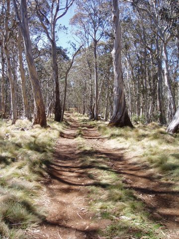
Massive national park a good 5 hours drive North of Sydney. Large plateau peaking over 1500m altitude (high enough for snow in winter) and dropping away sharply in all directions is criss-crossed with fire trail through beautiful native forest.
Polblue Camp Ground seems as good a place as any, off Barrington Tops Forest Road.
This is going to be a very limited report so apologies in advance. However, so impressed were we on a visit here that it just has to get a mention.
There are many firetrails marked up here. Actually - on our visit we found Polblue trail (actually marked as a walking track) had been freshly graded and very much resembled fire trail so was easy to ride (and drive - as obvious vehicle tracks showed). Map in hand and with a sense of adventure I'm sure many wonderful rides could be linked up here.
Polblue/Barrington Trail
Head 1.5Km West from Polblue camp ground and one should come across Polblue Trail heading south. Follow this and keep on going. Polblue itself is around 4.75Km long, after which it joins the main Barrington Trail so turn right there. You'll maybe spot Mistake Ridge before then but it's only an out and back and didn't like the name so can't comment on the riding there.
Barrington Trail continues South and splits about 700m after the junction with Polblue. When we were there Mount Barrington was signposted on the right so followed that although if you believe the topo both routes lead there.
There is just one more junction on Barrington Trail before it's end. A distinct left 'T' heads off to Junction Pools/Hole. Again, cannot comment on that as didn't take a look.
Eventually then, after about 16Km, you will come to the end of Barrington Trail. The peak of Mount Barrington is up a short, overgrown track but isn't very interesting.
We met other riders here who had come from the other direction, so maybe the Careys Peak Trail marked on topo is rideable - that would probably make an awesome route if possible, but looking at the terrain and topo things could get a bit swampy North of the other end of there so we gave it a miss. Turn around and head on back to Barrington Tops Forest Road the way you came.
North of the Road
Well, yes - North of the road (Barrington Tops Forest Road, that is) there are many more trails marked on the topo map. I'm sure there would be some more top riding in there. Sadly time didn't allow these to be checked out. Another destination on the 'must return' list!
Polblue camp ground has long drop toilets but not much more.
|
Mount Barrington Via Polblue/Barrington Trails
(32.24Km)
Beautiful firetrail route through native forest in Barrington Tops National Park. Don't expect a view at the end of this though. |
