You are hereMooney Mooney Creek - Aug 2017 don't bother. Just too rutted out, rocky without any flow. Walk only / Mooney Mooney Creek - Aug 2017 don't bother. Just too rutted out, rocky without any flow. Walk only
Mooney Mooney Creek - Aug 2017 don't bother. Just too rutted out, rocky without any flow. Walk only
At a Glance
Rougher than in the past but with some great single track. Grinding & technical climbs that make you grin from ear to ear on the descent.
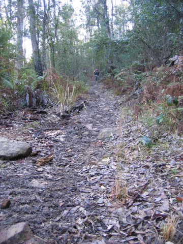
AUG 2017 - Just too rutted out now and covered with fallen logs/trees
Karool Road, Mooney Mooney Creek, NSW. There's a large-ish parking area right before the start of the trail.
This trail is actually part of The Great North Walk within Brisbane Water National Park. The park is so large with so many different sections that this gets it's own write up.
Parts of this area are on sections of the GNW, but why walk when you can ride? The trails are pretty wide in most places but that said, always bear in mind you may meet walkers so watch out for those on foot. Right, warnings out of the way, let's get to it:
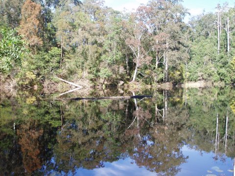
Head through the gate on Karool Road up a pretty standard looking firetrail. This runs with the creek on your right for quiet some time before crossing at what can only be described as a treacherous rock causeway (moss & algae made this as slippery as ice for us). With the creek now to your left carry on enjoying the amazing trail which just englufs you from all angles. Pass a few sections of rock gardens (again, very little grip there) before starting to climb a little and reaching the dam (which will be to the left).
From here on in there's plenty of slogging with around 175m vertical to climb over the next 2Km or so. First time I experienced this, the return trip wasn't on my mind, but let me tell you that coming back is one of the best descents you'll find. Or rather, back before terrible storm water erosion in 2007 it was - haven't been back for a while so hopefully things will be better now. It's all single track still of course, and some good speed can be had away from the more rocky sections at the top - yeah, you'll love those on the climb 
Atop this hill there's still plenty of fun to be had but sections of wider trail begin to creep in. Someplace near the water tanks (you'll know them when you see 'em) a road to 'The Bucket' peals off left (more on that later) or keep on following the GNW. The walk can hit you once more with some sections of technical stuff and of course more fantastic sections in the forest. Up here it also passes Keighly Road which I guess is a good start to do all this in reverse. Not long after passing Keightly Road we turned round so have no idea how things work out, although it looks on the map there's about 2km more before emerging on Robinson Road, Sommersby.
The Bucket
For those who haven't had enough climbing by the time they reach the aforementioned water tanks there is 'The Bucket'. From the tanks head down Reserve Road (sealed) or more likely the fire trail on the South (right as you descend) but at some point it's inevitable the sealed stuff has to be used. At the bottom of here there is a dam and small power station you'll pass on the right as you head off the bitumen before bottoming out and crossing the creek.
From here on it is one of the cruelest climbs around these parts - best part of 200m vertical in around 5Km of rough fire road, switchback after switchback to raise hopes of the end then dash them in an instant! Ah, but you love the challenge, right?! 
Top of this climb is the Brieses Road Trail Head, well, slightly to the West of the firetrail if you can find it. This is a nice alternate meeting point.
Carrying on with the bucket mission though, one again descends down the the creek on narrowing firetrail before meeting the creek by the dam you will have passed many Ks ago on the other side (bottom of the first large climb of the day if you came all the way from the freeway bridge).
From here unless you have a boat it's time to turn around and head on home, back up the hill is the only way. A ride involving The Bucket is tough stuff, the whole thing from the freeway and back is over 2000m vertical and over 30Km (or more if you choose to wonder further North past the water tanks), but challenging and rewarding along the way.
Nil
|
Mooney Mooney from Brieses Rd
(29.13Km)
Tough Mooney Mooney ride incorporating 'The Bucket' first then the trail by the Creek. Four big climbs and especially tough way to finish. |
| Title | When |
|---|---|
| Mooney Mooney - Sat 29th | 17 years 24 weeks ago |
| Mooney Mooney Creek | 17 years 43 weeks ago |
| Mooney Mooney (morning session) | 18 years 10 weeks ago |

