You are hereForums / NoBMoB News / Trails Database gets some TLC (and more to come)
Trails Database gets some TLC (and more to come)


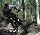
I'm not sure how much of this people will have noticed, but... thought it was about time to say a few words about our trails DB.
This started out as just a few words about local trails but after a quick glance at the page above you'll see it's grown into much more.
While this section of the site has been here for a long time, it's had a bit of TLC lately (and will get a bit more in the coming weeks & months).
There is a whole load of information here and it can be a bit daunting, so in general the changes are aimed at making it easy to find 'stuff I like'.
The changes so far have been:
- Remove reliance on Google Maps in favour of Leaflet - looks great on mobile.
- Nice little thumbnail maps on the 'At-a-glance' section for each trails area.
- Introduction of a point of information (POI) content type. Instead of just listing facilities we can now pinpoint them on a map (with relevant icons of course).
- Maps for individual areas can now show trails colour coded by difficulty (where authors have rated them), as well as those POIs.
- As well as the Northern Beaches area overview map on the trails DB overview there's a new Trails Finder page that shows all the areas to ride on a map.
- A little reminder message on all these content types: this is a site for the MTB community, and as trail info can often change, anyone is welcome to contribute with better information if they have it. You know - just like a wiki.
Well, that's for a start... there's more coming! Yes, a nerd's work is never done! 
- Login to post comments
Great work Rob. The POIs are very useful, especially knowing where the nearest tap is.
Agreed, Leaflet does look good on my mobile. (Galaxy S3)
Updating some POIs
I would like to add another Category called "Landmark" so we can highlight interesting, significant and/or historical places that can be found in the area.
I also found when viewing a ride page the POIs at the bottom of the page show an Icon and description but not the title.
Tim
The title being omitted on the ride page is by design. You don't really need it there. Title is used on the map when you hover.
For other places, like 'Landmark' it is best to post a geo-coded picture in the area's gallery.
Majority of the existing NobMob photos are not geo-coded. The recent photos I took are not geo-coded Is there a way to edit and add this in?
Ok, just found the photo layer in the maps was switched off, once on I could see alot of the photos. One problem I'm finding now is the Photos layer defaults to off.
Photos are off by default. This is by design because otherwise the maps can look cluttered.
There is a message above the map about using the layer control. Nobody reads instructions though, do they?
Nope lol
Anyway we can set our preference in our profiles? I'd like mine defaulted on.
Will put that on the todo list.
Rob
This is the extended trail mentioned on the side discussion. I think it would be 90% legal. (ie there are 2 footbridges that you need to walk across).
http://www.strava.com/routes/83541
I think that's worth advertising as its a much better way to connect up the Dam and other good riding. I know a lot of people already use it.
That's not really a trail though is it? Looks a lot like a road ride from one area to the other.
We have a ride profiles section here for describing nice routes to take. If someone has a nice loop from Manly Dam to Cascades (via the above) and back again then all good, please post it up
Rob
You're the boss. I would just point out that while it has tarmac every so often I take you do pick up that most of it (75%+) is running by the pipeline which is fire-trail like. Agreed there are a number of interludes so its not your classical trail for sure.