You are hereHighest rated images
Highest rated images
| Teaser | Votes | Rating | My rating | |
|---|---|---|---|---|
 |
2 | |||
 |
2 | |||
 |
Here is a summary of some data I collected. |
2 | ||
 |
2 | |||
 |
Hope you'd agree this is probably worth paying a little extra for. Especially in the current economic climate. |
2 | ||
 |
2 | |||
 |
Oh dear |
2 | ||
 |
2 | |||
 |
2 | |||
 |
2 | |||
 |
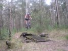
Bars, grips and seat ex-MTB. Brakes just functional, gears for display purposes only. |
2 | ||
 |
What happens when you turn the flash off and your camera decides to take a 1 second exposure |
2 | ||
 |
As you came into transition it would post your time. The was the first time I had seen this set up and it worked nicely because you could see you time but more importantly confirm your chip had registered properly. They also had wifi and you could also check live on the internet. In the pic you can see Craig's lap of 38:50. Nice time |
2 | ||
 |
1 | |||
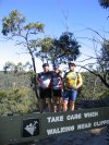 |
Yes, take care! |
1 | ||
 |
Ah... there's an alright view at the end of this ride (well, depending on how you do it). Earlier in the day the ranger said he'd rather you didn't ride to this lookout, but getting late as it was only passed a couple of walkers on it. Be sure not to cycle off the cliff! It was down to 8 degrees celcius at this time (just gone 5pm, mid April) so probably not a good thing to finish up much later! |
1 | ||
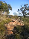 |
Looks great in the morning sun. |
1 | ||
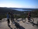 |
Red Hill view |
1 | ||
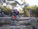 |
This is how you do it!! |
1 | ||
 |
If you can see it through the fog Directions here. |
1 | ||
 |
1 | |||
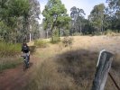 |
You have to wonder how much of this grass will be around in summer. In this area there's a few rather nice sections winding around in tall grass with a lot of switchbacks. |
1 | ||
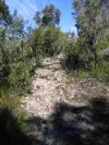 |
Somewhere on the Coba Ridge Fire Trail - the bike (and hence uphill route) are on the return from the point. |
1 | ||
 |
Struggle up those hills, at least someone's smiling about it |
1 | ||
 |
1 |
