
You are here
nobmob.com

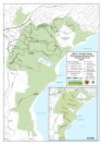
Cascades update for 23 Nov
RFS update page shows TFB removed and fire danger decreased: http://www.rfs.nsw.gov.au/dsp_TOBAN_HTML.cfm
Do you have more information?
If you've ridden here lately please add a more recent report. This will be useful even if the condition is the same as updates expire after 30 days.
Please do not post comments with such information - post a new update with the link above.
Please do not update this post with such information - post a new update with the link above.
Bobbin Head update for 23 Nov
RFS update page shows TFB removed and fire danger decreased: http://www.rfs.nsw.gov.au/dsp_TOBAN_HTML.cfm
Do you have more information?
If you've ridden here lately please add a more recent report. This will be useful even if the condition is the same as updates expire after 30 days.
Please do not post comments with such information - post a new update with the link above.
Please do not update this post with such information - post a new update with the link above.
Berowra Valley - Quarry road firetrail update for 23 Nov
RFS update page shows TFB removed and fire danger decreased: http://www.rfs.nsw.gov.au/dsp_TOBAN_HTML.cfm
Do you have more information?
If you've ridden here lately please add a more recent report. This will be useful even if the condition is the same as updates expire after 30 days.
Please do not post comments with such information - post a new update with the link above.
Please do not update this post with such information - post a new update with the link above.
Bairne Track update for 23 Nov
RFS update page shows TFB removed and fire danger decreased: http://www.rfs.nsw.gov.au/dsp_TOBAN_HTML.cfm
Do you have more information?
If you've ridden here lately please add a more recent report. This will be useful even if the condition is the same as updates expire after 30 days.
Please do not post comments with such information - post a new update with the link above.
Please do not update this post with such information - post a new update with the link above.

rides located close to train stations in sydney area
Hey guys does anyone know of many trails located close to train stations other than woodford too glenbrook(the oaks)? north south east west il go anywhere its a loss of lisence situation.. thanks in advance for any locations

Nowra trails
Hey does anyone know the locations of the Nowra XC trails? The scum website doesn't have directions on it.
I know where the Coondoo track is, but does anyone know where the Butterfly, Super Bowl and Cabbage Tree trails are?
Cheers.

Insanely hot
Loz and I did 8 laps in 6.5 hours. The race was cut short by two hours due to the extreme conditions.
Temps were up around 44. It was ridiculously hard...for me anyway.
Time to go lie down and die now.......will update later
The forecast was for 40+ temps and again I knew this would be bad for me given my previous performance at Mogo in the heat.

Wildflower to Terry Hills via rylands - perimiter trails
Hi just wondering if anyone could give me some info on this ride. It looks possible from looking at the maps page but is it an easy ride to get lost on? [eg. spending all day back tracking from dead ends] Also if possible, which direction Terry Hills - StIves or vice versa? I'm riding Rylands, Wildflowers next weekend weather permitting so will get a bit of a look at that end, then thinking about a big loop on the 6th or 13th. If this loop can be done how many km's? cheers.

The only DAM place to ride on Sunday
The meeting times are 'ready to ride'. If you need time to prepare equipment then please arrive a few minutes earlier.
King Street (near corner with Arana Street), Manly Vale. You know - outside Manly Hydraulics Lab.
SO, every thing else is closed due to a 'questionable' fire risk, so I'll be lapping the dam for a few hours on sunday morning.
All welcome to join in for a lap or several until it gets too hot.
I'll expect to be pacing the laps around the 36-37 minutes, the idea being to get into a steady groove and keep the flow. Happy to pause at the top of climbs if someone is a bit slower on the steep bits but generally able to keep up the pace.